Team Camaro Tech banner
1 - 20 of 24 Posts

ZZ_430

· Registered
Joined
·
6,543 Posts
Discussion starter · #1 ·
Guys, I'm thinking about moving into the 21st century.

I have never used a GPS and I don't have a clue.

As the title says' I'm looking to spend around $300 max for a good unit. I will be using it in my GMC 4x4. We do a lot of driving in and around National forests, not so much in the city or on interstates.

There are tons of different brands and models out there now.

I like the looks of the Garmin nuvi 2797LMT for about $270.

http://www.bestbuy.com/site/garmin-...h-and-lifetime-map-and-traffic-updates/7534216.p?id=1218849837492&skuId=7534216

I was hoping to get some real world feedback from people that have actually used a GPS.

A few dumb questions:

1. How often do they update information? Is it whenever it becomes available (immediately?) or is there a delay in getting updates? Let's say a bridge is out or a road closed.

2. Are there "blind spots" where there is no satellite reception?

3. What else can a GPS do other than the obvious mapping and directions?

4. Will I have to buy more features to add in the future?

Thanks in advance guys.
 
The Garmins are great. Be sure to get a model that includes lifetime maps.

The model you posted has Bluetooth. If you don't need BT then buy one of the lessor expensive units.

I use one that was about $100 that does a great job.

This one is nice if you don't care about the Bluetooth

http://www.bestbuy.com/site/n-252vi-52lm-essential-series-5-gps-with-lifetime-map-updates/7534076.p?id=1218849837491&skuId=7534076&st=categoryid$abcat0301014&cp=1&lp=2

You can enter destination by address, intersection, points of interest such a gas station, banking, food, shopping categories or spell out the name of the business.

I update mine about every 6 month. Just plug it in the computer with the USB. Takes maybe 10 minutes.
 
Discussion starter · #3 ·
The Garmins are great. Be sure to get a model that includes lifetime maps.

The model you posted has Bluetooth. If you don't need BT then buy one of the lessor expensive units.

I use one that was about $100 that does a great job.

This one is nice if you don't care about the Bluetooth

http://www.bestbuy.com/site/n-252vi-52lm-essential-series-5-gps-with-lifetime-map-updates/7534076.p?id=1218849837491&skuId=7534076&st=categoryid$abcat0301014&cp=1&lp=2

You can enter destination by address, intersection, points of interest such a gas station, banking, food, shopping categories or spell out the name of the business.

I update mine about every 6 month. Just plug it in the computer with the USB. Takes maybe 10 minutes.
Thanks John, that looks like a good deal for me. I don't need BT.

That's what is great about Team Camaro, info sharing :beers:
 
I use a Garmin 60CSX for snowmobiling and it is great. It's a rugged handheld and not really designed for use while driving a car or truck (for example it doesn't speak, only beeps). The only reason that I even raise this is that there are models that are great for specific uses like boating, sledding, hiking, etc. but for simple up to date turn by turn directions with up to date maps, do you really need more than a decent smartphone? I guess if you don't have one or want something hands free or integrated into your vehicle, then a dedicated GPS is definitely better, but for infrequent use I get by with iphone and blackberry apps, just a thought.
 
Garmin makes a good product. On your question about updates, traffic type stuff like temporarily closed roads, accidents, etc come through as soon as they are put on the wire. If your're doing navigation you can set it to automatically reroute you around traffic issues or other stuff. Actual map updates, I'm not sure how often they're done but if you register you'll get an email whenever a new one is available.

Some have built-in mp3 player and fm transmitter or other stuff....you know, things that are nice if using a radio that's old. If you look at the "specifications" page on best buy you'll get an idea some of the stuff that's available.

I can't remember ever losing satellite contact. If you do you can still use it like a map and now they're so big you can actually use them....mine is old and only 4.3" screen. Like John mentioned you can just type in stuff to look for (almost like google maps). I don't think there's really any features to ad.

My dad is 77 and if he can use one, you can too.
 
Discussion starter · #7 ·
Garmin makes a good product. On your question about updates, traffic type stuff like temporarily closed roads, accidents, etc come through as soon as they are put on the wire. If your're doing navigation you can set it to automatically reroute you around traffic issues or other stuff. Actual map updates, I'm not sure how often they're done but if you register you'll get an email whenever a new one is available.

Some have built-in mp3 player and fm transmitter or other stuff....you know, things that are nice if using a radio that's old. If you look at the "specifications" page on best buy you'll get an idea some of the stuff that's available.

I can't remember ever losing satellite contact. If you do you can still use it like a map and now they're so big you can actually use them....mine is old and only 4.3" screen. Like John mentioned you can just type in stuff to look for (almost like google maps). I don't think there's really any features to ad.

My dad is 77 and if he can use one, you can too.
Thank you Steiner, good info. Just what I wanted to know.

Yes, I am old. lol.:beers:
 
Thanks Lyle, I don't have a smart phone. I was also wondering how detailed the maps are for forest roads?
you might be better off with Topographical maps than "city/street" maps if you are looking for forest roads. They are terrain maps with elevations, creeks, swamps, etc. That is what I use for snowmobiling and they are great for what I use them for. Street maps are great for what they are intended for but don't get much into the off road details that can be very useful.
 
Discussion starter · #9 ·
you might be better off with Topographical maps than "city/street" maps if you are looking for forest roads. They are terrain maps with elevations, creeks, swamps, etc. That is what I use for snowmobiling and they are great for what I use them for. Street maps are great for what they are intended for but don't get much into the off road details that can be very useful.

Cool, thanks again :thumbsup:

That's what I needed to know. I had no idea about any of that.
 
Agree with all the above, I really like the Garmin interface. It's very user friendly.

My wife has built in NAV in her Audi and its not very intuitive at all. I have a Kenwood in my Jeep with Garmin and its great.

I have a Clarion head unit in my '67 with Nav, and its ok, but not as good as the Kenwood/Garmin.
 
you might be better off with Topographical maps than "city/street" maps if you are looking for forest roads. They are terrain maps with elevations, creeks, swamps, etc. That is what I use for snowmobiling and they are great for what I use them for. Street maps are great for what they are intended for but don't get much into the off road details that can be very useful.
X2 :thumbsup:

Wish I had a $ for every time a GPS showed me a 'developed' road went through an area I was traversing - when it really didn't :angry:
While I still use gps based or my iPhone app (in the satellite mode) to navigate some areas, as soon as things get dicey I pull out the Topo's and give them a good once-over - before I drive off a cliff ...

While we have several dedicated GPS's and even GM in-dash systems, I just returned from one of my bonsai runs to Texas and back using nothing but my iPhone to check roads and traffic conditions the whole trip :yes:
 
Discussion starter · #12 ·
Agree with all the above, I really like the Garmin interface. It's very user friendly.

My wife has built in NAV in her Audi and its not very intuitive at all. I have a Kenwood in my Jeep with Garmin and its great.

I have a Clarion head unit in my '67 with Nav, and its ok, but not as good as the Kenwood/Garmin.
Thanks Brent, I'll have to look into the Kenwood.
 
Discussion starter · #13 ·
X2 :thumbsup:

Wish I had a $ for every time a GPS showed me a 'developed' road went through an area I was traversing - when it really didn't :angry:
While I still use gps based or my iPhone app (in the satellite mode) to navigate some areas, as soon as things get dicey I pull out the Topo's and give them a good once-over - before I drive off a cliff ...

While we have several dedicated GPS's and even GM in-dash systems, I just returned from one of my bonsai runs to Texas and back using nothing but my iPhone to check roads and traffic conditions the whole trip :yes:
John, when you say pull out the topos do you mean regular paper maps?
 
John, when you say pull out the topos do you mean regular paper maps?
If I happen to have them - which I do for several areas in CA/AZ/CO/TX that I've done some serious off-highway and trekking in ...
Otherwise I use some downloaded info from a site like topoquest.com or one of two apps on my iPhone :thumbsup:
 
Discussion starter · #15 ·
Thanks for the info John :cool:

We are into 4-wheeling whenever we get the chance....which is quite often now that I am retired.

Last year I found out all about AZ mud during the monsoon season. I made the mistake of pulling off a single-track 4wd trail to park. It "looked" ok...lol....next thing I know I was up to the axles in some seriously soft ground! :noway: The old Jimmy gave up!

Forget trying to dig out...it was like concrete that was just setting up! I got chains and a high-lift jack after that!

That was when I learned to stay on hard packed trails around here.

Where I'm from (CO) mud looks like mud!
 
Thanks for the info John :cool:

We are into 4-wheeling whenever we get the chance....which is quite often now that I am retired.

Last year I found out all about AZ mud during the monsoon season. I made the mistake of pulling off a single-track 4wd trail to park. It "looked" ok...lol....next thing I know I was up to the axles in some seriously soft ground! :noway: The old Jimmy gave up!

Forget trying to dig out...it was like concrete that was just setting up! I got chains and a high-lift jack after that! ...

Where I'm from (CO) mud looks like mud!
I still enjoy a nice bounce around the woods and outback from time to time with my 77 Chevy K-30 4X4 :beers:
I was a real treat to explore in when I lived in CO in the early 80's :thumbsup:

I couldn't tell you how many vehicles I've pulled out of 'solid ground' like that :p
Mostly tourist that ventured onto the "Flats" areas of CA and salts of UT to explore ...
Most have no idea that the 'dry' is just a crust covering the quagmire below :eek:
Same goes for the sandy areas of these states - used t be a 'gas money' venture at Pismo to pull folks out of sand before we headed home after a weekend :D

To me being stuck was part of the fun ... and sort of like being pregnant, you were or you weren't ... if I could get it out by jacking and blocking I was just delayed - if I needed a tug out then I was 'pregnant'/stuck ... ;)
And luckily I was only really only stuck once - at Pismo - to the door sills in soft sand at the bottom of a bowl :sad:
Since it took 3 other vehicles hooked together to tow me out, and two of those got stuck in initial tries, I felt sort of vindicated in my needing rescued ...
It's another reason I still don't have a winch - I've only found them useful for pulling other people out as there weren't many trees or other solid objects to anchor to in most of the places I frequented :noway:
 
Discussion starter · #17 · (Edited)
I still enjoy a nice bounce around the woods and outback from time to time with my 77 Chevy K-30 4X4 :beers:
I was a real treat to explore in when I lived in CO in the early 80's :thumbsup:

I couldn't tell you how many vehicles I've pulled out of 'solid ground' like that :p
Mostly tourist that ventured onto the "Flats" areas of CA and salts of UT to explore ... Most have no idea that the 'dry' is just a crust covering the quagmire below :eek:
Same goes for the sandy areas of these states - used t be a 'gas money' venture at Pismo to pull folks out of sand before we headed home after a weekend :D

It's another reason I still don't have a winch - I've only found them useful for pulling other people out as there weren't many trees or other solid objects to anchor to in most of the places I frequented :noway:
Most have no idea that the 'dry' is just a crust covering the quagmire below

There ya go! That's what I was trying to say!

To me being stuck was part of the fun ... and sort of like being pregnant, you were or you weren't << LOL

What part of CO?
 
Most have no idea that the 'dry' is just a crust covering the quagmire below

There ya go! That's what I was trying to say!

What part of CO?
The beautiful suburb of 'Grandview' :thumbsup:
Just above Rocky Mountain Lake off Federal and I-70 outside of Denver proper.
Used to 'wheel' a lot in the area above Georgetown, up near Winter Park, through the Basalt Valley and also down in the Telluride/Ouray/Silverton/Durango (over Imogene(sp?) and Black Bear passes) areas.
Been over most of the major peak trails and from Leadville over to Aspen on one great adventure :beers:

Also did the "Fast Camel Cruise" in the CA low desert several times back-in-the-day - it was fun showing the Jeep boys just what a GM vehicle could do if driven right :thumbsup:
 
Another vote for the Garmin nuvi series, I have 3 of them we use in our household. One has lifetime maps but it's the oldest and has less features. Having a new base map once a year insure all the new housing tract streets and new roadways are on your unit and if you use the find gas or food features having that updated yearly is helpful but we have found those things are not that important when we use our gps' because we have smart phones to look for gas station and places to eat. For that matter the smart phone is also a gps but not as good to use when driving. The newest one we have (nuvi 265w) is the only one that has Bluetooth which does come in handy when driving and you have to take a call. It also has a special antenna in the power cord and receives live traffic info and I really like seeing when something is coming and being able to avoid by setting an alt route. This feature would probably know if a bridge was out and re-route you. If you don't have this feature your yearly updates would not know about it for the rest of the year. All models get some updates but it's to the operating system not the map data.
 
I have seen some of these when I was looking.

https://buy.garmin.com/en-US/US/on-the-trail/handhelds/etrex-20/prod87771.html

And the entire page.

https://buy.garmin.com/en-US/US/on-the-trail/handhelds/cOnTheTrail-cHandheld-p0.html

Living in AZ off-roading is a great past time. Not sure what your wheeling with but I know out a here a GPS really helps and most of thee places to go are mapped and have weigh points in the guides to see the sites.

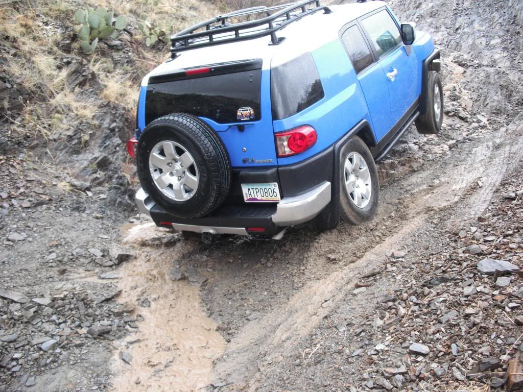
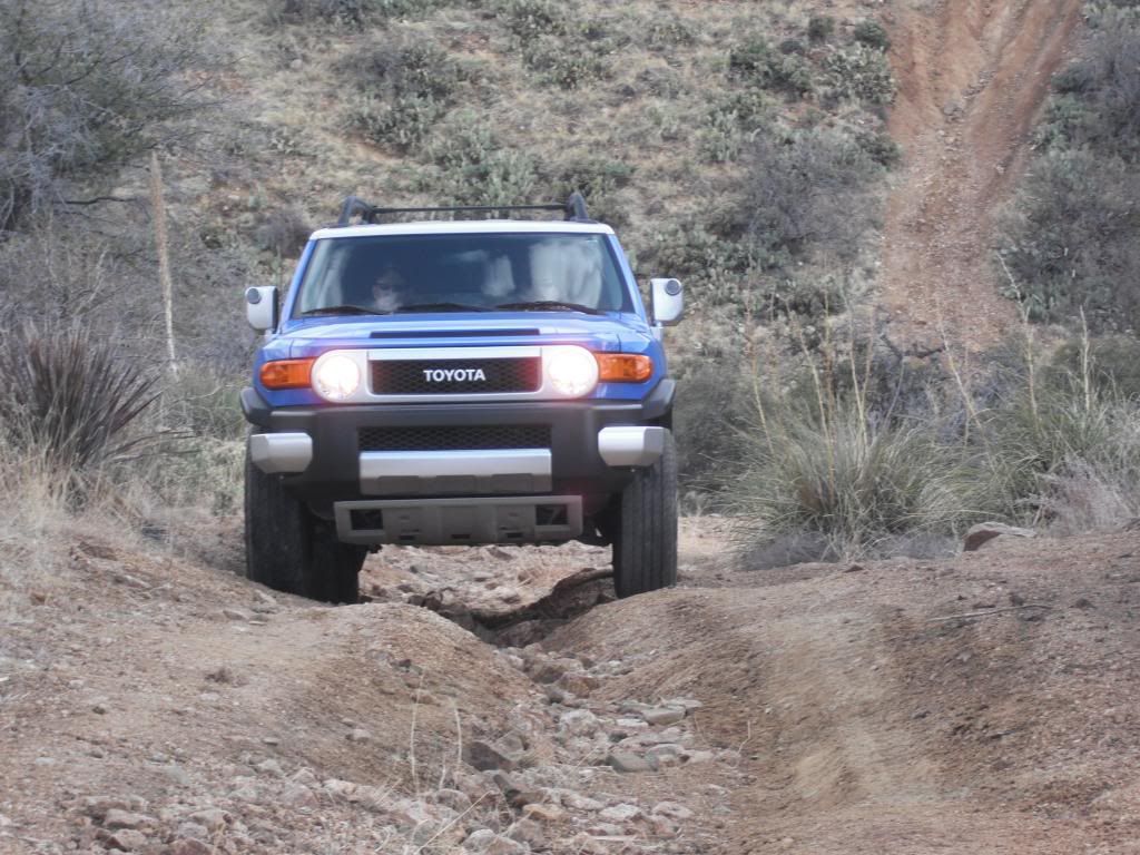
I have a Toyota FJ cruiser. It's great rig and off roads very well. I wanted the Jeep 4-door Rubicon but the FJ was such a good deal and provided off road capability that I was amazed with, locker (electric), posi, A-Trak, good clearance. I need GPS also....there is so much to see here!!! I want to do the guided Grand Canyon off road tour sometime. Off-roading here can be very addictive!!

Image


Image
 
1 - 20 of 24 Posts